|
| Sunrise at the Rio Grande Campground |
 |
| The Store |
 |
| Boquillas Canyon |
 |
| Illegal Border Crossing |
 |
| Leaving the West Part of Big Bend |
 |
| The Ride up to the Chisos Basin |
 |
| Rocks Looking Over the Basin |
 |
| Chisis Basin |
 |
| Chisis Basin |
 |
| Terlinga Ghost Town |
 |
| Terlinga Ghost Town |
 |
| Dog Rest Area |
 |
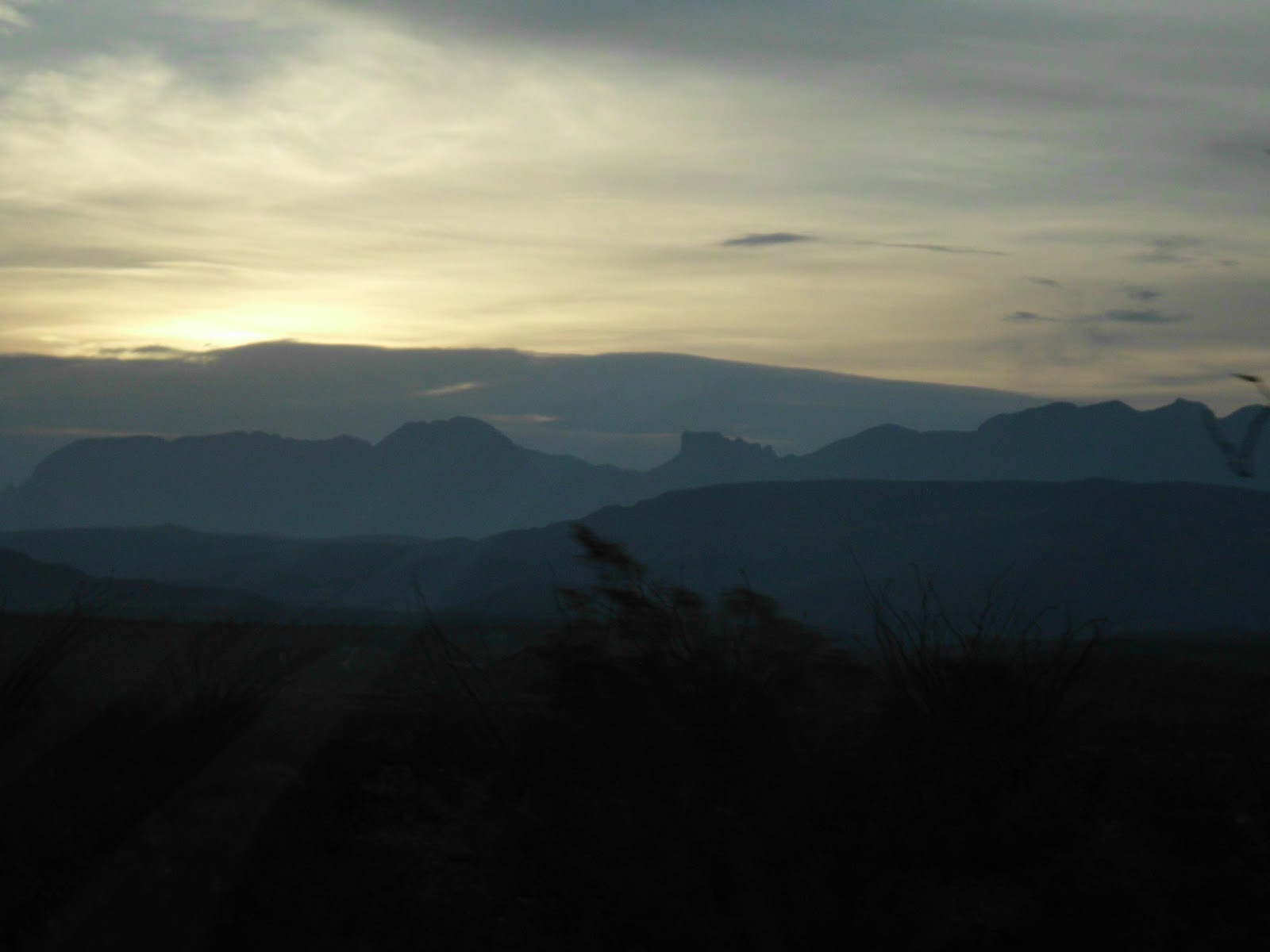
| Sunset Over Terlinga |
 |
| Mexico in the Distance |
 |
| Sunset at the Rio Grande |
 |
| Beep Beep!!! |
 |
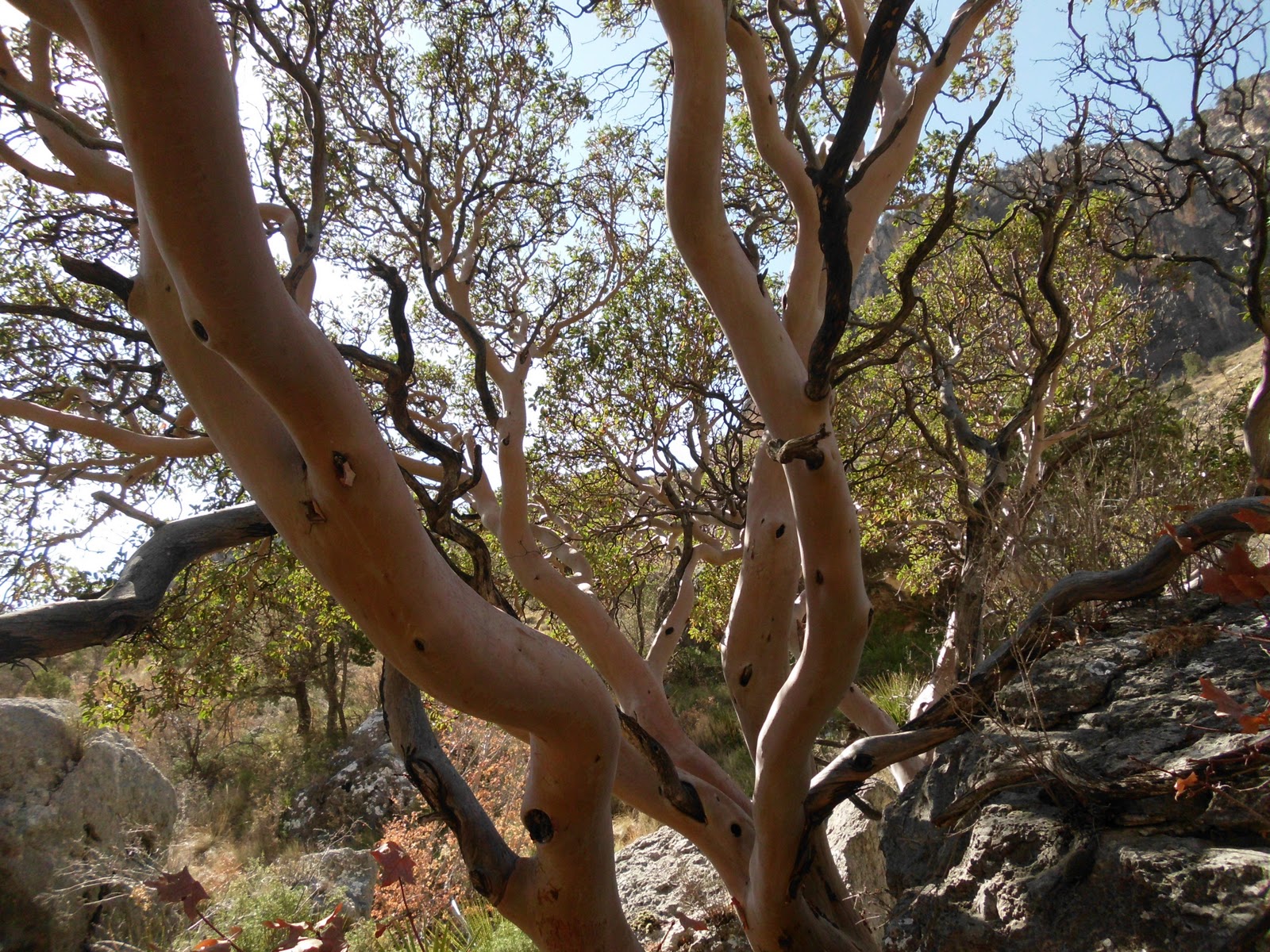
| New Cactus |
 |
| Rio Grande |
 |
| Boquillas, Mexico |
 |
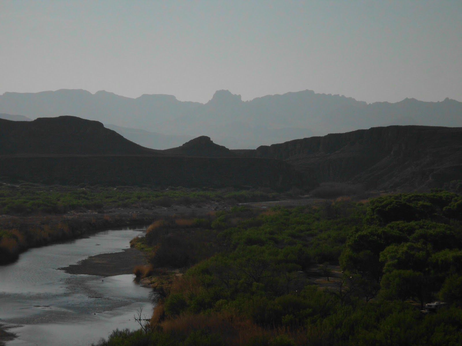
| View from our Campground |
As we left Stillwell we watched a family of javelinas cross the road in front of us. They are the cutest little pig like animals. I was told by someone-“Not pigs!!!!! They are javelinas which are in the family of Peccarys!!!!” There were close to a dozen of the small, black and gray fellows. (Later on in the campground, Sandy listened to many many of the little creatures snorting and bellowing in the middle of the night.)

To tell you about Big Bend I have to drag out all my really long adjectives. Magnificent, awesome, amazing. The thing is that the scale is grand. We entered the park and as soon as we came over the rise, a new world opened up. Across miles and miles of desert we could see phenomenal (there’s another one) mountains. 360 degrees around were these rocks jutting up into the sky. And every direction’s mountains had a different quality. Some were smooth and low, some were jagged and angry. The drive from the edge of the national park to the edge of the first mountains is 30 miles. Mostly flat, but ups and downs at times past lone hills, giant hoodoos, small canyons and draws. The Chisos Mountains sits in the middle of Big Bend Park and are a truly Awesome sight. They are a somewhat circular patch of perhaps 30 mountains where the outer mountains are strung together with common bases. It is maybe 10 miles wide. Many of the inner mountains do the same. From different directions you see different sets of mountains. They crash up into the sky most with sharp peaks. The South Rim is more continuous with lots of little peaks atop the rim. I have been hearing about the “Basin” as the camping area in the middle of the Chisos for months from friends. A road switchbacks impossibly up the north side and down into a flat area in the center of the range. There is a campground and a lodge and the start of dozens of hiking trails. This is where I want to go. Imagine my disappointment when we hear that the recommended vehicle length to get into the Chisos Basin is 24 feet. Our rig is 27, but note the word “Recommended”. The problem is that I am married and want to stay that way. “Doug! We are not taking our home up into the clouds where the experts say it shouldn’t go. Fine, end of story. So we head to a perfectly wonderful campground on the Rio Grand with an amazing towering solid range of mountains in front of us and other smaller ranges on every other side. Sounds perfect. Do you remember one of the reasons that we went on this trip? Do you remember 12 below zero, blizzards and roads closed because of 10 foot snow drifts? Okay, now enter (I swear this is true- a camper near us read it) 117 degrees. Well, you are not supposed to swim in the Rio Grand and there is no electric in the park for the air conditioner. We made the best of it and explored the smaller hills and watched a beautiful sunset over the River.
At the campground I have fulfilled a deep childhood fantasy. Within an hour we have seen both a coyote and a roadrunner. Beep, beep!
The only way to hike is to go out early in the morning and find shade in the afternoon. Crack of dawn the next morning we set out for Boquillas Canyon. Boquillas is a Mexican town across the Rio Grand, thus just across the border. I had seen it on a previous walk from the campground to a hill a few miles away. Now as we climbed the steep switch backed trail up the hill on the way to the canyon we could see the town close up. One-story buildings sprawled out over a ½ square mile, overlooking the river, many trails through the desert brush and cactus to the water. As we walked we found little “stores”. Presentations of handmade goods, mostly beaded scorpions and plants and 5 foot walking sticks, mostly crooked and painted with desert scenes on the top. We found dozens of these stores as we walked. All with jars to put money, a flat rock price-list in the center. We had been told not to buy- it was contraband and would be confiscated if found. There were also jars with a note rock that asked for money from Victor the singing Mexican. We had been told about him and been asked not to encourage him. (Sadly he never showed. Too early for Victor!) The walk to the canyon was flat after the steep up and down. We walked right beside the Rio Grande through sand and grass and cactus. After about a ½ mile we noticed movement. A horse. No two. There were 6 horses, no saddles or bridles, just one with a bell. They grazed on grass until we reached them and then they moved with us. Finally we entered the canyon. The opening 1/8 mile wide, with cliffs towering above us 500 feet. As we walked, the canyon narrowed until the walls were 50 feet apart and the trail finally gave out to cliff rock pushing into the water instead of the soft sand and tall grass and bamboo like brush. The horses had swum across the river and were grazing on a grassy sandbar on the Mexico side. Our walk back, the sun finally rising higher than the giant wall of rock to our east, we were close to the top when 3 riders appeared below, riding on the sand on the Mexican side. They called to us “Ola”. We called back. “Want to buy a walking stick?”, they called, and rode their horse across the river, certainly an illegal border crossing. “No thanks”. And we crested the hill.
We have made a decision. The weather is forcing us to move once again, only this time we will move north to evade the heat. We will figure a way to see what we want, but we had planned to lounge in this amazing beauty. But there is no lounging in this heat. After Boquillas we head back towards the Chisos Mountains. We will head for a town west of the park and electric and air conditioning. As we pass the road up toward the Chisos Basin, remember my dedication to my marriage, I suggest, just before the turn off, “maybe we could drive up and see how far we could get and turn around?” I get a little nod and swerve the RV up the road and nail the accelerator. We climb, but not to excess. The mountains are closer and more and more amazing. Still no crazy turns or elevation. We slowly climb and climb and then it is there in front of me, the little sign that shows the arrow doubling back on itself, the hairpin turn and we can see that in its crazy turning it also climbs straight up. I want to turn around and head back, but there is no where to do that. I nail it again and head up. Up and up we go, the RV straining, but doing okay. More hairpins and more straight ups and there is nothing to do but drive on. Finally we reach the highest point and then it heads straight down again into the Chisos Basin. Thank God there is a pull off for a trailhead and we park. Since the first hairpin turn, I have missed the beauty of the mountains, but now I am swallowed by it. The jagged peaks we saw from so far away are there in our faces. We are surrounded by craggy rock, throwing itself skyward. Below us is an amazing flat plain littered with trees. I will not go down there, not even tempted. I can see straight down the road’s path, and switch backs abound- far more than on the ride up. We rest and stare at the beauty and finally turn the big rig around and head back. The ride down is hairy, but we make it, smelling the brakes cooking the whole way. What a wonderful experience at the hands of very poor judgment.
We make it to Terlingua Ghost Town mid afternoon. The ghost town is quaint and seeing that it is after 2, everything is closed. We find a store and buy mass quantities of ice cream. It is way over a hundred and we find a place to rest and pull in. We drawn the shades, turn the air on, get out large spoons for our ice cream and watch a movie. Ah the wilderness!!!!!